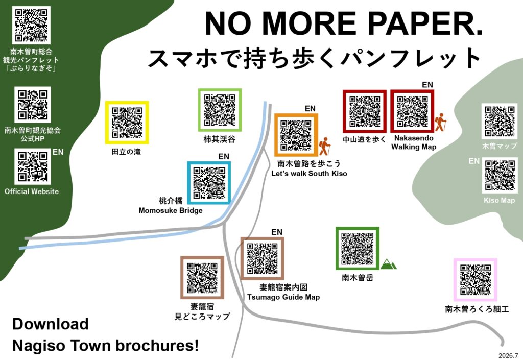
Tourist information / guide map / pamphlet digital version
You can download the PDF file.
| Tsumago-juku Guide map | .jpg) | This is a guide map of Tsumago-juku and Otsumago area, and Naksendo trail from Tsumago-juku to Magome pass. |
|---|---|---|
| South-Kisoji Trail Map | 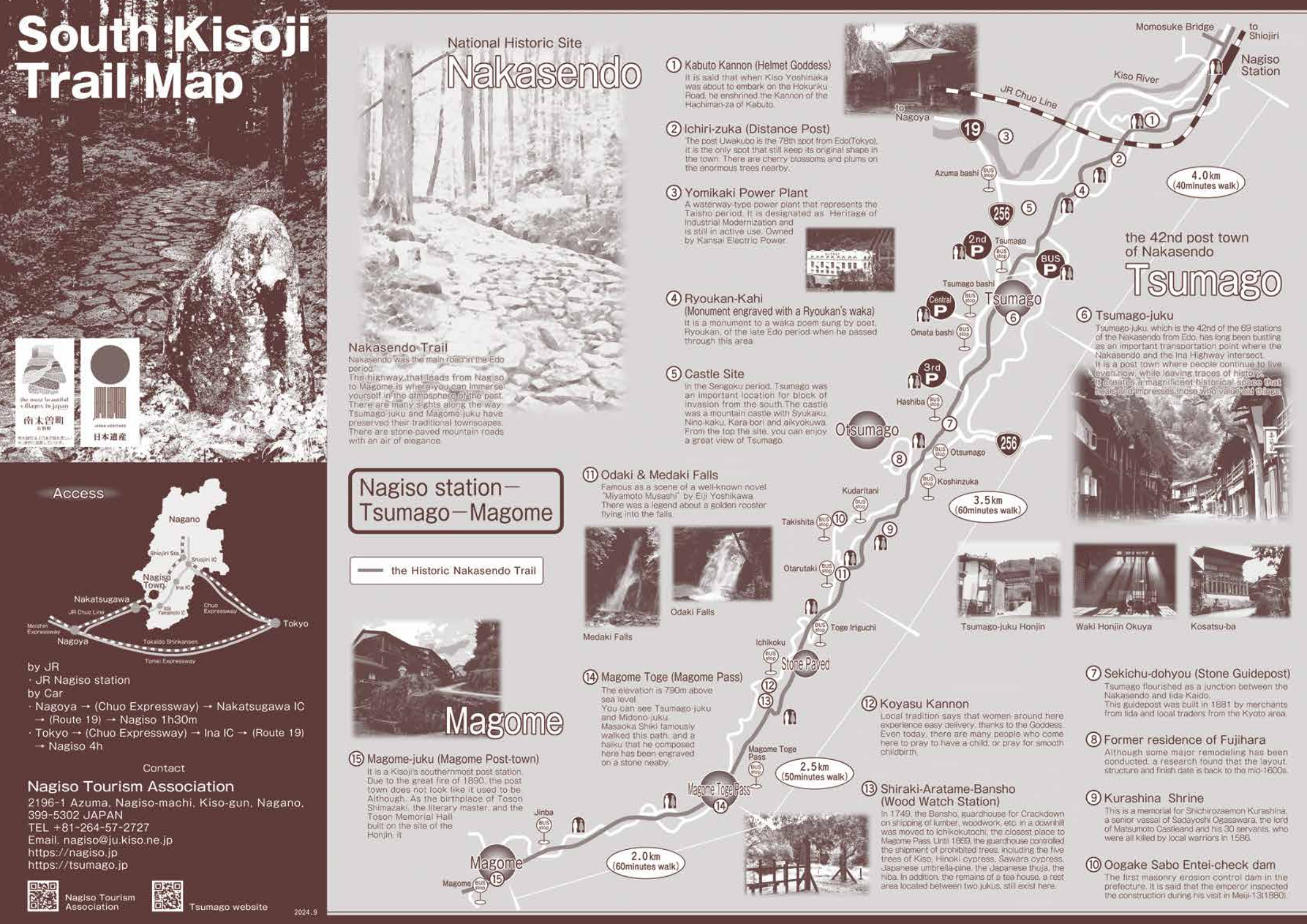 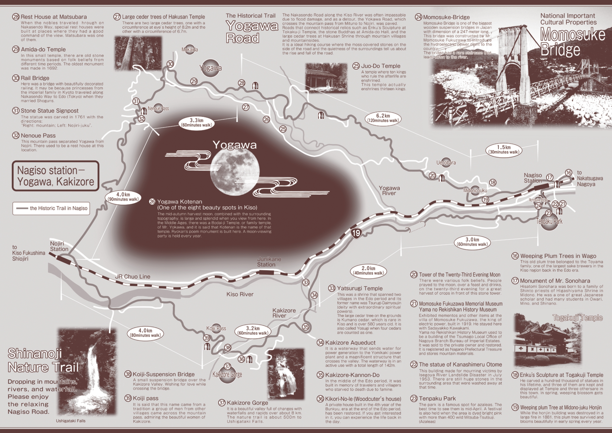 | This is a walking guide map from Magome to Tsumago, Tsumago to Nagiso Station, and Nagiso to Nojiri (Yogawa-Road course, Kakizore Gorge course). |
| Midono-juku Guide Map | 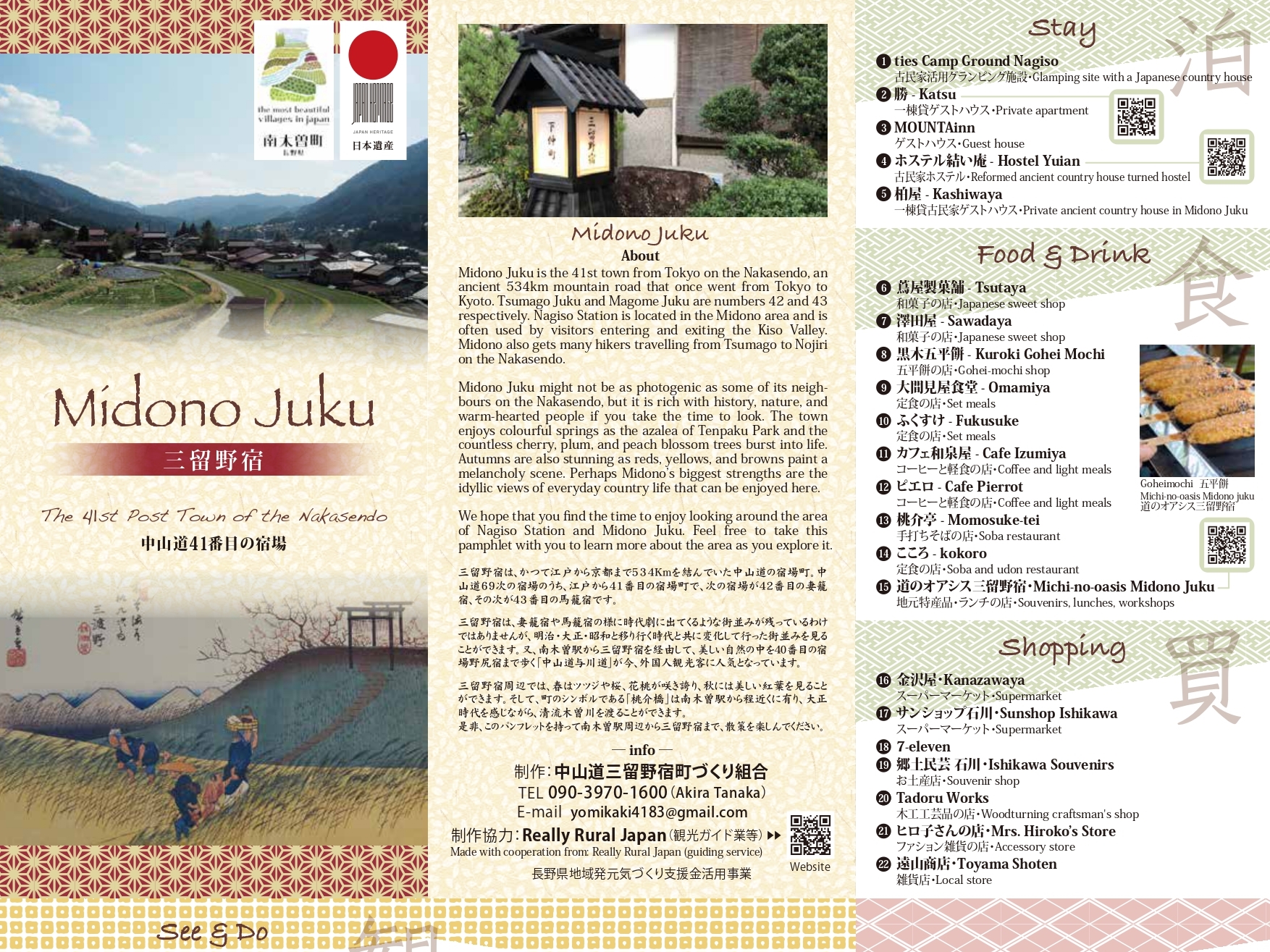 | This is a general information map of Midono-juku. Explanations of spots, restaurants, etc. are introduced along with the map. |
| Mt. Nagiso Trekking Guide Map | 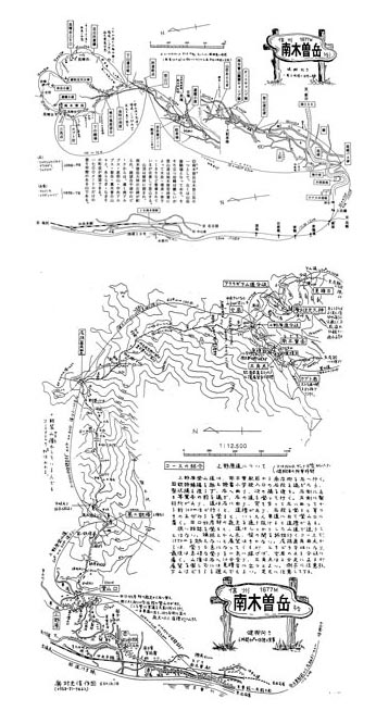 | This is a map of Mt. Nagiso trekking course. ※Japanese text only |
| Nagiso Historical Trail Guide Map | 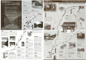 | This is a guide map of the historical trail, which is from Magome-juku to Nojiri Station via Tsumago-juku and Midono-juku. The trail from Magome-juku to Tsumago-juku is the Nakasendo, and from Nagiso Station to Nojiri Station is the Yogawa-road. |
| Kakizore Valley Guide Map | 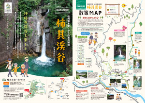 | This is a guide map of Kakizore Valley and its surroundings. ※Japanese text only |
| Tadachi Waterfalls Guide Map | 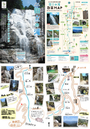 | This is a guide map of Tadachi Waterfalls and its surroundings. ※Japanese text only |
| Momosuke Bridge | 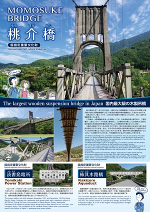 | This is a Information leaflet of Momosuke Bridge, and other nationally designated important cultural properties and facilities in and around Tenpaku Park. |
| Inaji/Kisoji Trail Guide | 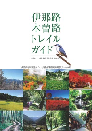 | This is a trail guide of trekking courses in Ina and Kiso area. You can see it in the electronic pamphlet. ※Japanese text only |
| Nagiso traditional woodturning “Nagiso Rokuro Zaiku” | 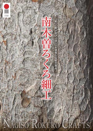 | This is a brochure about the traditional woodturning in Nagiso called “Nagiso Rokuro Zaiku”. ※Japanese text only |